Cumberland River
5 km west · Free camping
Where the Cumberland River meets the ocean. Small protected beach, sheltered from the prevailing swell. Free Cumberland River Holiday Park camping ground next to the beach. Excellent picnic stop.
One of the safest swim bays on the Great Ocean Road — plus the surf at Lorne Point, the river beaches at Cumberland, and how to read the conditions before you swim.
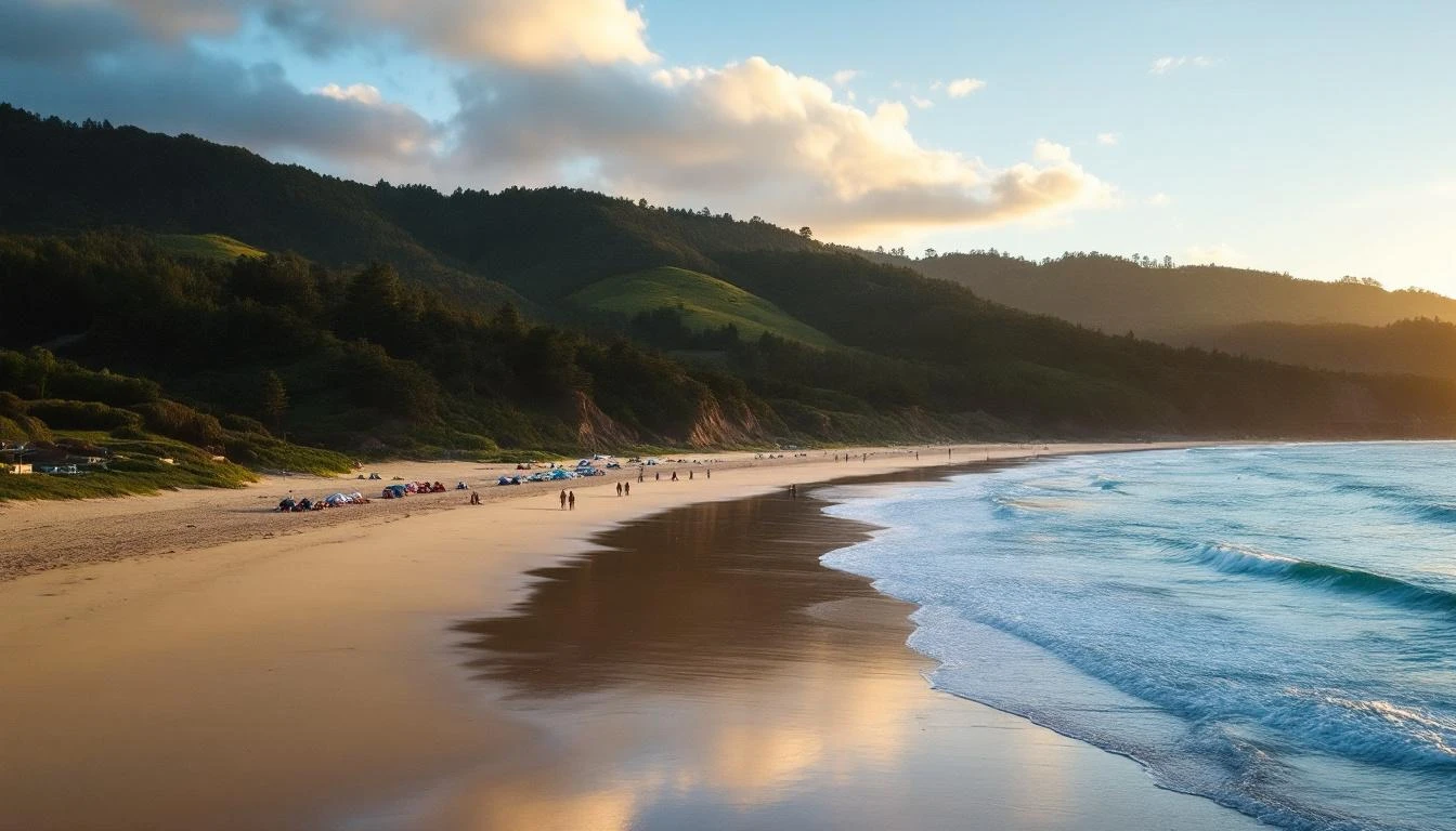
Lorne sits inside Loutit Bay, a shallow crescent carved between two basalt headlands. That geometry is the entire reason Lorne works as a beach town. The headlands break the heaviest Southern Ocean swells before they reach the bay, leaving Lorne with the kind of gentle waves that suit families, surf-school beginners, swimmers, and stand-up paddlers. The same headlands also block the strongest winds — Lorne is reliably 5–10 km/h calmer than the open coast either side of it.
That sheltering is exactly why Lorne has been a swimming destination since the 1880s. While the open coast at Anglesea, Aireys Inlet, and the Twelve Apostles is dramatic but dangerous, Lorne is dramatic and swimmable. It's the only major town between Torquay and Apollo Bay where you can swim with confidence.
Below: a full breakdown of every beach in and around Lorne, what each is good for, and the practical safety information you need before you swim.
The 1.5 km curve of golden sand directly in front of town. The beach drops off gently into clear water; the bottom is mostly clean sand with occasional shallow weed beds near the western end.
The western headland of Loutit Bay where the swell wraps around and creates a long left-hand point break. One of the most reliable Surf Coast waves outside of Bells Beach itself — picks up nearly any south-west swell.
5 km west · Free camping
Where the Cumberland River meets the ocean. Small protected beach, sheltered from the prevailing swell. Free Cumberland River Holiday Park camping ground next to the beach. Excellent picnic stop.
2 km west · Pebble + sand
Short stretch of pebble-and-sand beach below ochre cliffs. Less swimming-friendly than Loutit Bay (rocky in places) but a quiet picnic alternative when town is busy.
15 km west · Wide and quiet
Wide, mostly empty beach. Patrolled in summer at the river-mouth section. Best for travellers who want Lorne-style swimming without the Lorne crowds.
20 km west · Koala spot
Quiet beach plus the famous koala forest just inland. Often combined with a beach lunch and a wildlife drive on the same morning.
25 km north · Patrolled
25 minutes north toward Anglesea. Patrolled bay beach. Often calmer than Lorne when Loutit Bay catches direct south swell.
15 km north · Photo + walk
Long open stretch of beach north of the Memorial Arch. Not patrolled. Better for walking than swimming, but stunning at sunrise.
Loutit Bay is sheltered but not safe in all conditions. Three things to check before swimming:
For real-time conditions, the Swellnet Lorne report is the local benchmark. Check the day's swell direction, period and wind before deciding where to swim.